Over the weekend I managed to get out and visit one of the corners of the United States, Cape Flattery, on the western most edge of Washington state. I guess it depends on what you classify as a corner, but, I classify it as the northwest corner... well of the lower 48 states. It hit me that I've actually been to three of the four corners now. Miami, or more specifically, Key Biscayne I imagine would be the southeastern most corner - or possibly Key Largo, both of which I have been to. I've also been to Imperial Beach near San Diego to cover the southwestern most corner. Now I can scratch the Northwest off of my list! I guess the only thing I have left is Madawaska, Maine, but I don't foresee myself doing that anytime soon. The first two were unintentional anyway.
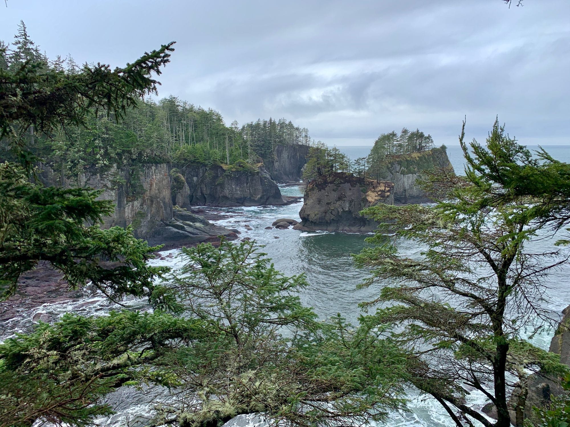
Cape Flattery was on my todo list for quite some time. I can remember seeing pictures of it as a kid and thinking to myself, "Ooo, I'd really love to go there! That looks lovely." When I first ever saw a photo of the place it looked fantasitical; almost magical. Let me tell you, photos don't do it justice. It is much more impressive up close and in your face. The in person 360º views are far more stunning than what a simple camera can easily convey.
I can see this place being super busy during season so I appreciate the fact that we made it out there a bit "off season". However, off season did have some unforseen drawbacks. Firstly, I should have planned better and brought a few days worth of supplies. Neah Bay is not too far away from the cape - which itself is only a 15min slow twisty drive up a cliff from "downtown" - but unbeknownst to myself, Neah Bay doesn't have much there and during off season, it has even less.
We set out fairly early in the day from Tacoma as the drive out there is about 4 hours from the Tacoma area. It's a beautiful drive out there and worth every moment, but still long. We arrived in Port Angeles at just past 10am and took a small break to decide what to do for lunch. It was still too early, but we didn't have anything with us - again, next time I plan to provision more. Looking on the Google machine and on other various apps, we saw some places to grab a bite in Neah Bay itself and it would be afternoon by the time we got out there from Port Angeles.
Having popped back onto the 101 for a bit only to be directed off to SR112, which is a winding and a not-well-maintained road, for another hour or so. No cell reception at all. Upon reflection, I should have picked up a detailed map of the area when we were in Seattle the day before. Literally at the best map shop in the United States that morning. So easy to pick up one. At any rate, I had to rely upon the turn by turn directions being fed to me by my phone. Luckily, the whole journey was already cached, but anything new or any emergency, would have been bad. Not a soul on the road apart from us.
Abandon all cell reception, ye who enter here.
Neah Bay is a very small town on the Makah Reservation. It's honestly more like a quiet fishing village than a small town. There is a very small USCG base there, but even that seemed like it was just 1 tiny cutter, a helio pad, and a pier. The tribal museum and cultural center was interesting and does not mince words about their tribe's plight with european settlers. It is fascinating to see what the Makah tribe accomplished living out in the dangerous beauty that is Cape Flattery with nothing but their sense of community, their wit, and impressive skills handed down through the generations.
After a stop at the cultural center, we began the search for lunch. There are about 3 places, that we could find, there to eat. Out of the 3, only 1 was actually open during off season, and even then I think they only stayed open for us as they were having issues with their wood fire oven. I have to say, if you are ever in Neah Bay and are looking for a bite, check out Linda's Wood Fired Kitchen. They are so friendly and the pizza was excellent.
Driving out to the cape from Neah Bay was relatively easy compared to the winding broken and long road we had to take just to get to Neah Bay. The view from the car was cliffy and wooded, much like all of the cape, but only peek-a-boo views of the ocean.
At the end of the road is a rather small parking lot with limited RV parking and compost toilet facilities. So if you are heading out there, be prepared to perhaps hike to the trail that you have to hike down to get to the vista during season. The lot was quite full apart from two empty spots when we got there in the off season. Granted it was a holiday weekend, so perhaps traffic was higher than usual in off season.
The trail itself was not bad, though muddy due to recent rainfall - I mean we are in Washington after all. One should come to expect things like this. About a thrid way down, the trail becomes a series of wooden planks for making your way down easier, but these are hardly ADA compliant and are still a task to accomplish. So if you are thinking it is an easy way down without the need of any assistance, you will be disappointed. As hikes go, it's easy. As walks go, it is an obstacle course that you have to pay attention to else end up slipping or tripping. Hiking back up is mildly harder due to the grade, but completely doable.
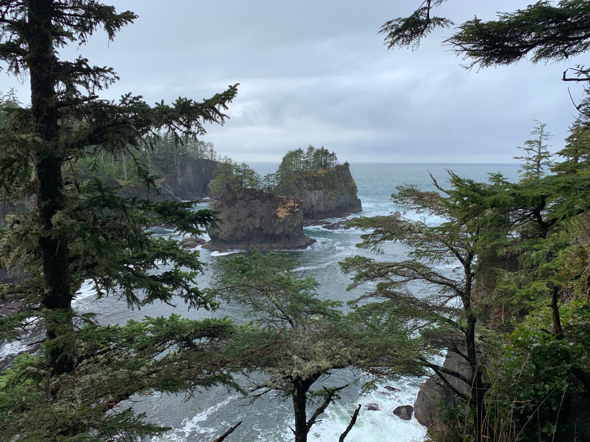
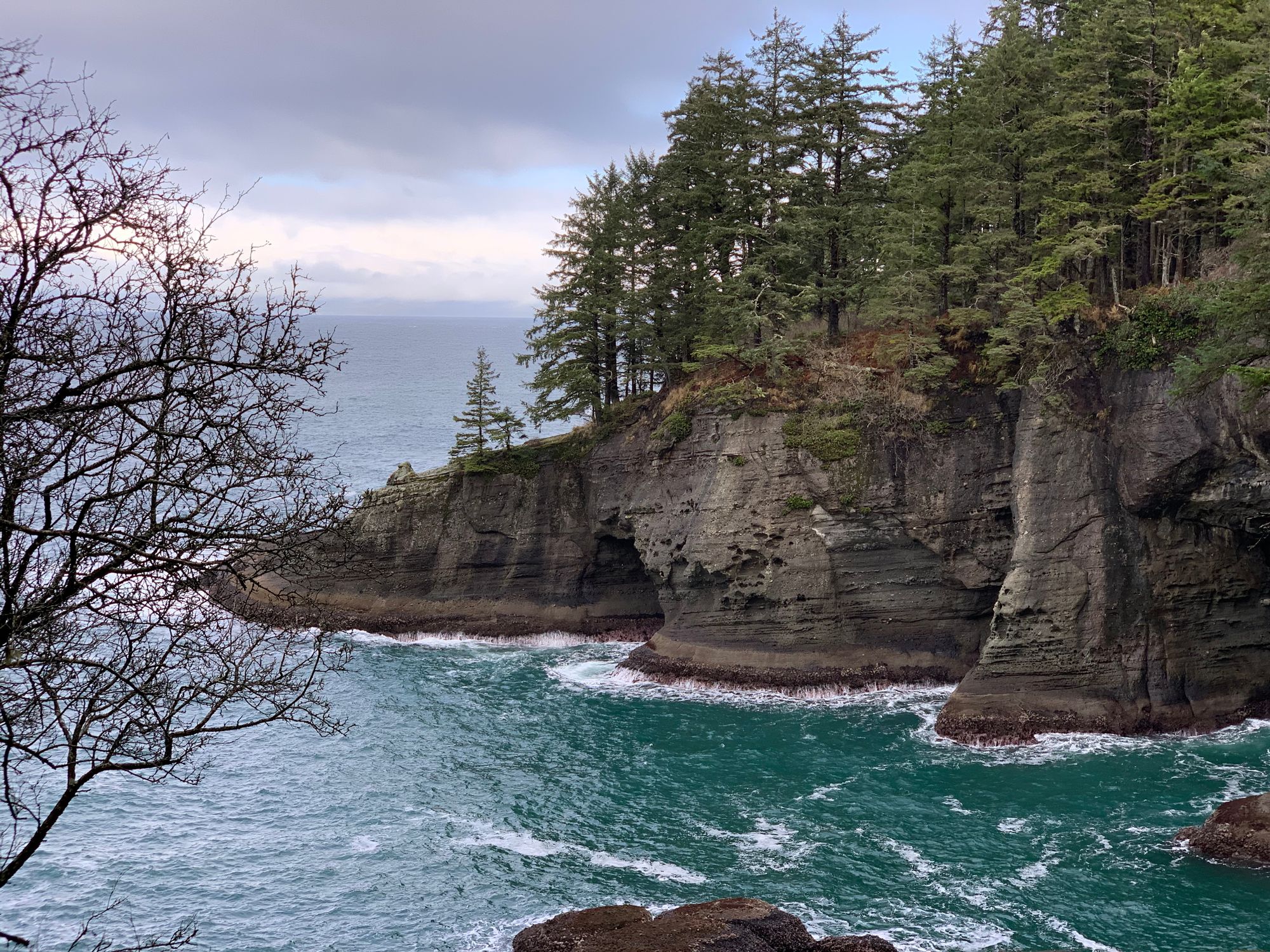
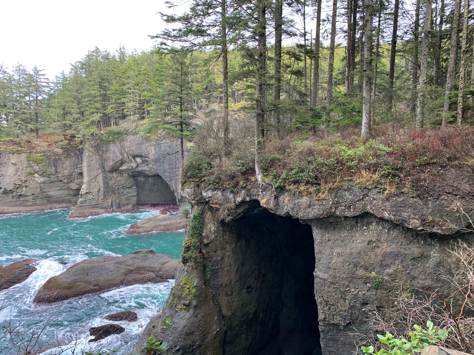
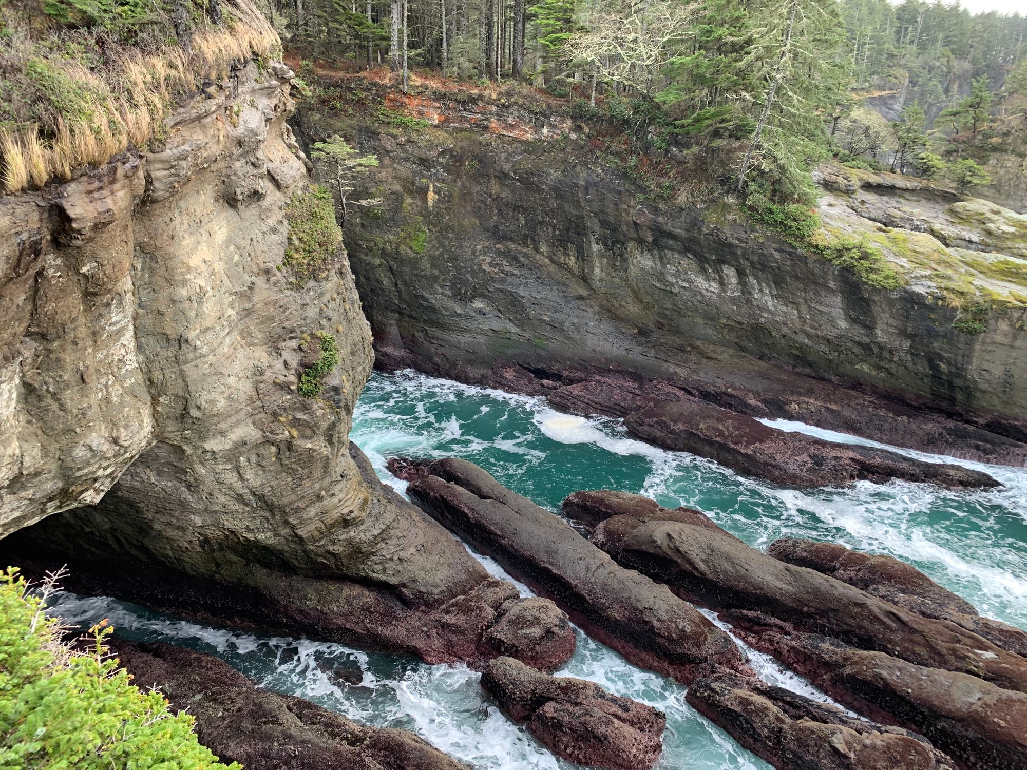
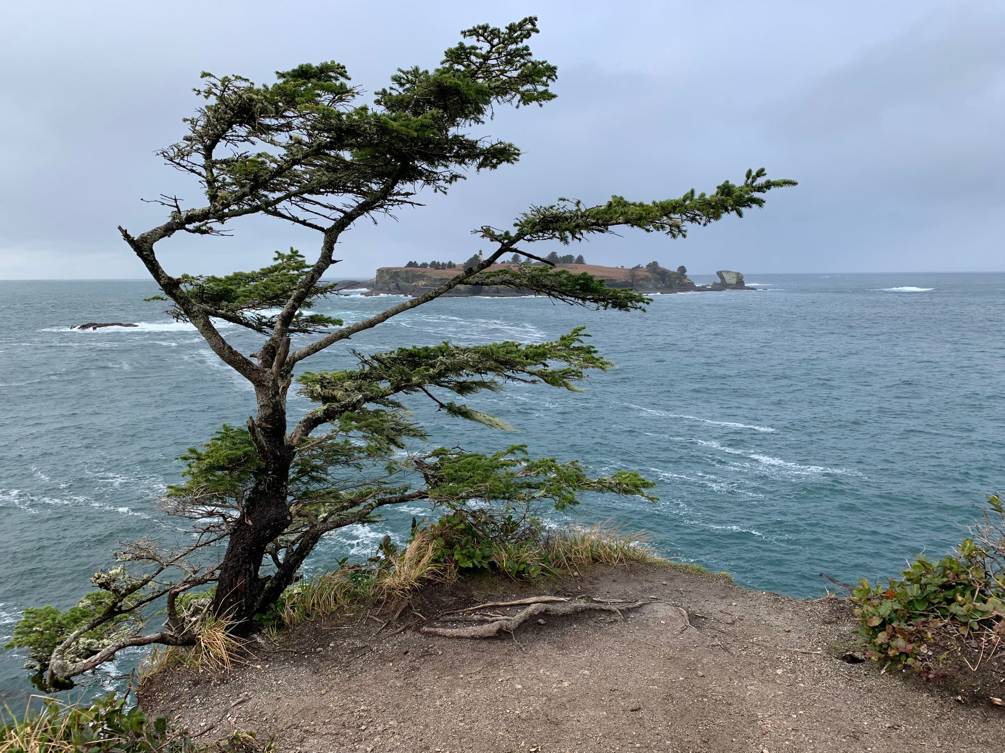
Along the way there are a couple of observation decks to take in the more impressive views. I suggest going to them all. Benches are provided so you can sit and enjoy the wicked splendor of mother nature and our planet.
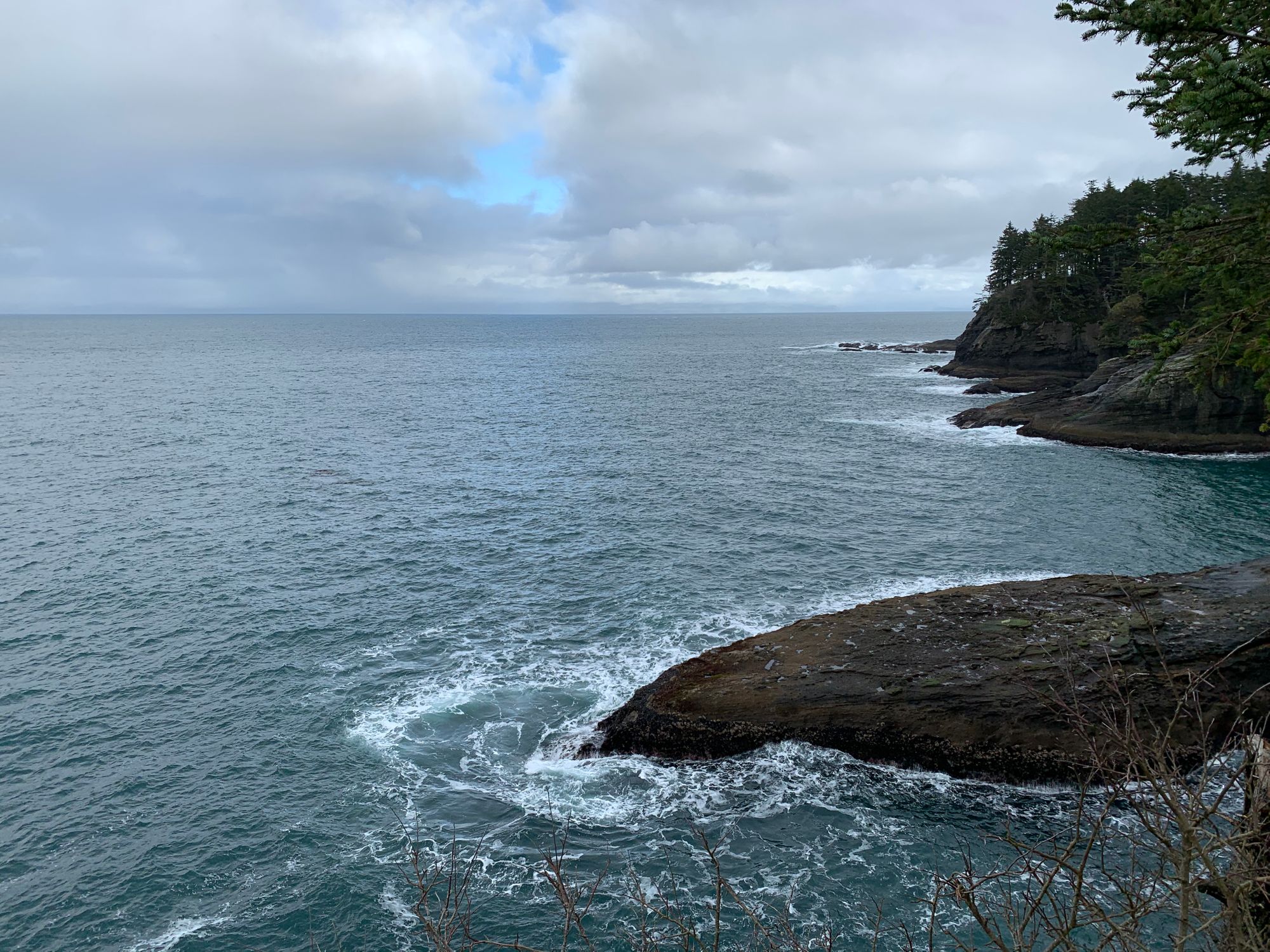
At the very end of the trail is the main observation deck that lets you look out on to the Pacific and Tatoosh Island with its lighthouse.
The cabin in the woods on the beach.
After gaping in awe over the natural splendor of Cape Flattery, we headed to our cabin not too far from the cape. In fact it was closer than the town of Neah Bay, or at least it seemed that way. The cabin was situated practically on Hobuck beach itself. It was also far more "luxurious" than I was expecting. The only thing missing for the "convenience" of civilization - other than any cell reception - was a local market for provisions. Again, had I thought it through better, I would get stocked up on the way in. The cabin had a microwave, running water, coffee maker - basically all the home comforts.
Since we had thought that the local town would be able to provide, we made no effort to be prepared. So we had to make an over hour long journey to Forks to get some supplies and dinner. Getting to Forks is long and not as twisty, but it is pitch black and it had started to rain so it was an arduous and stressfull drive there and back.
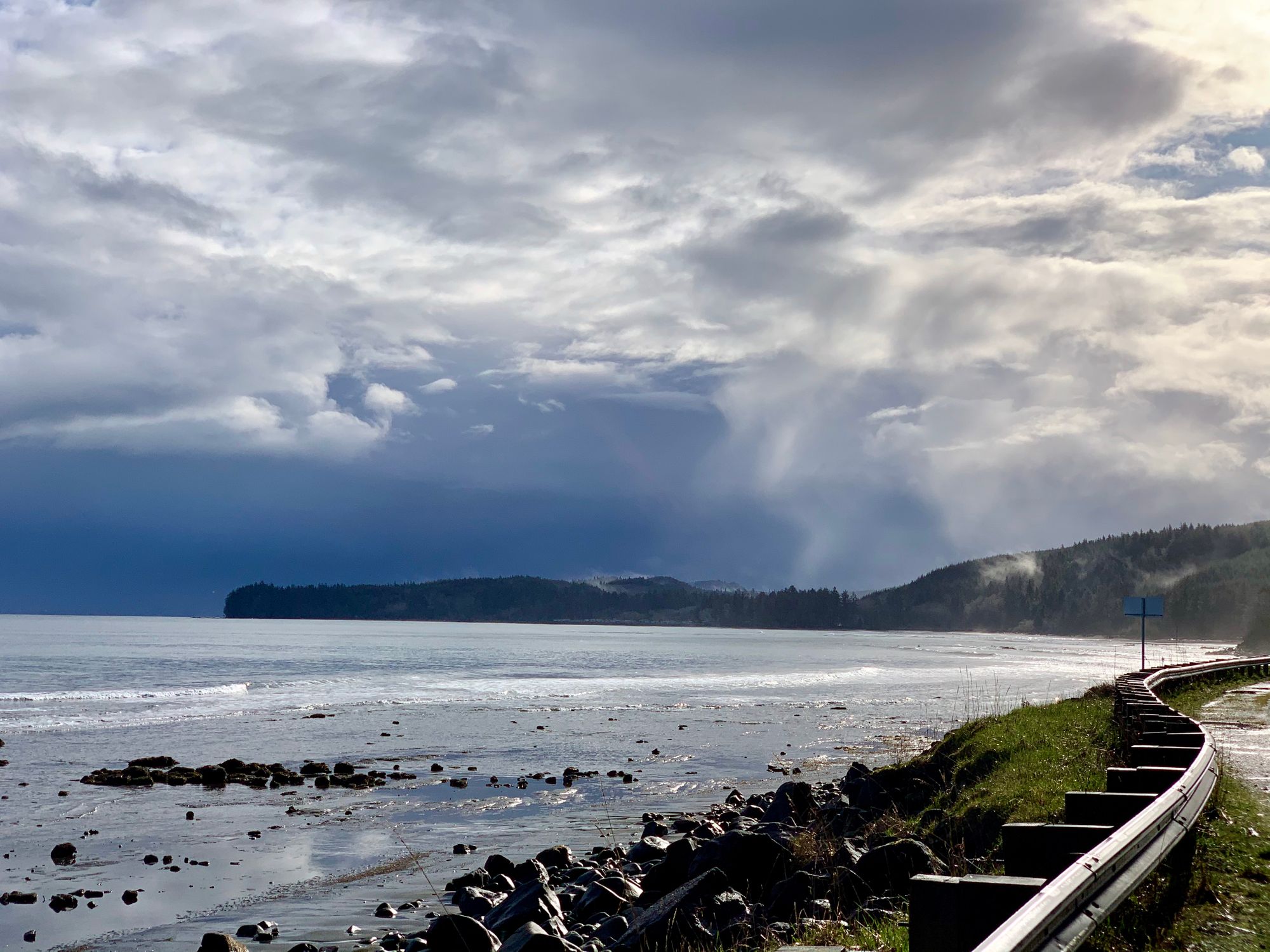
The next morning was dramatically beautiful. A fashion for the day that I have some to expect and admire out here in the Pacific Northwest. Grey skies, raw power of the ocean, and the omni present and majestic tree covered mountains. Clouds ladened with mist and moisture too heavy to float over them that they are torn apart by the tree line like wisps of cotton.
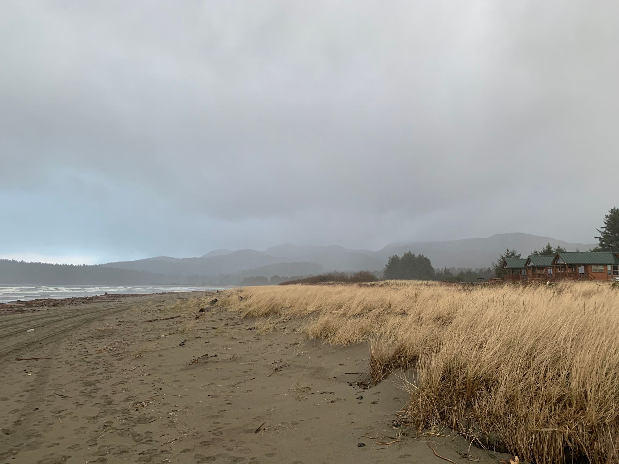
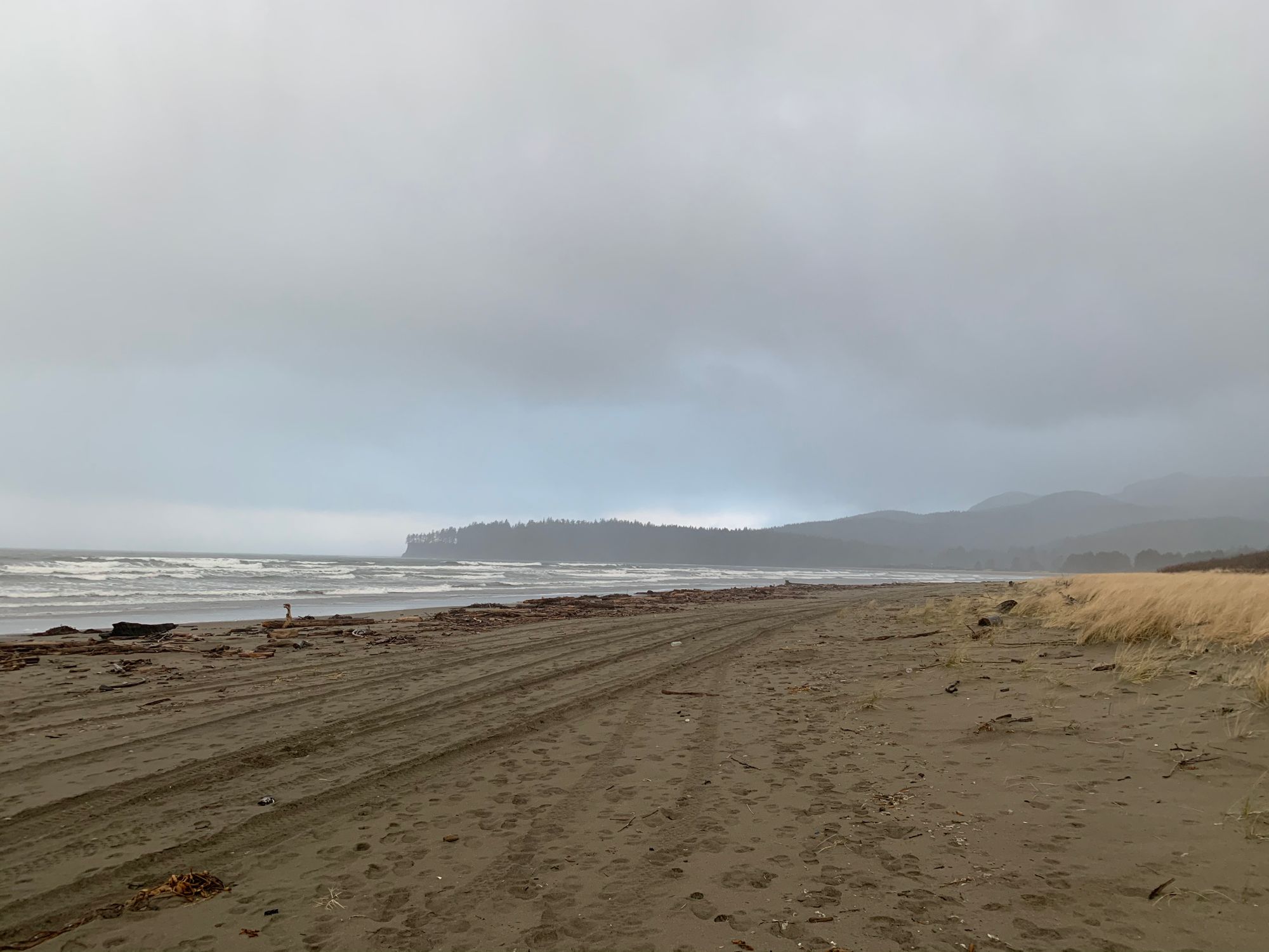
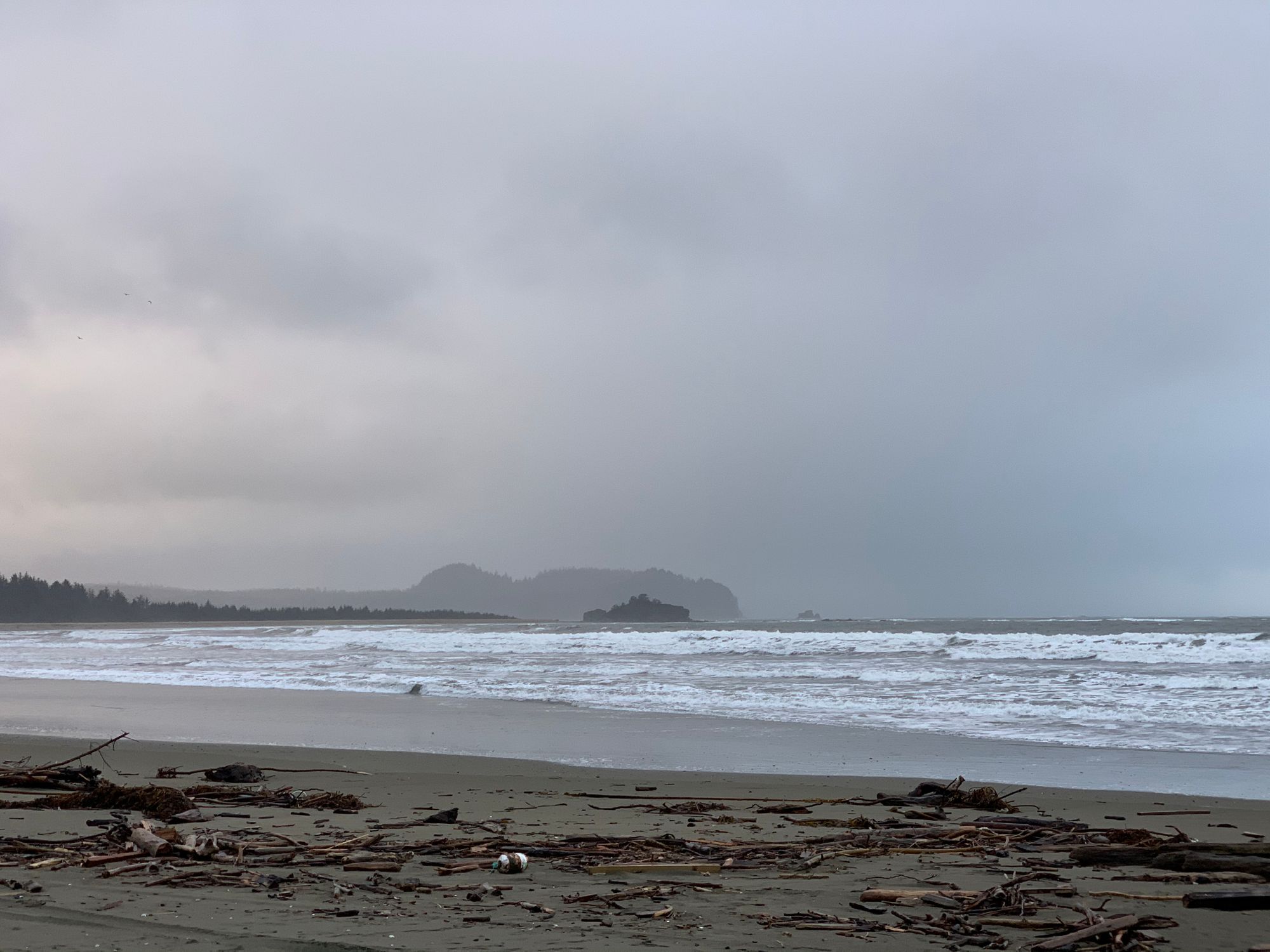
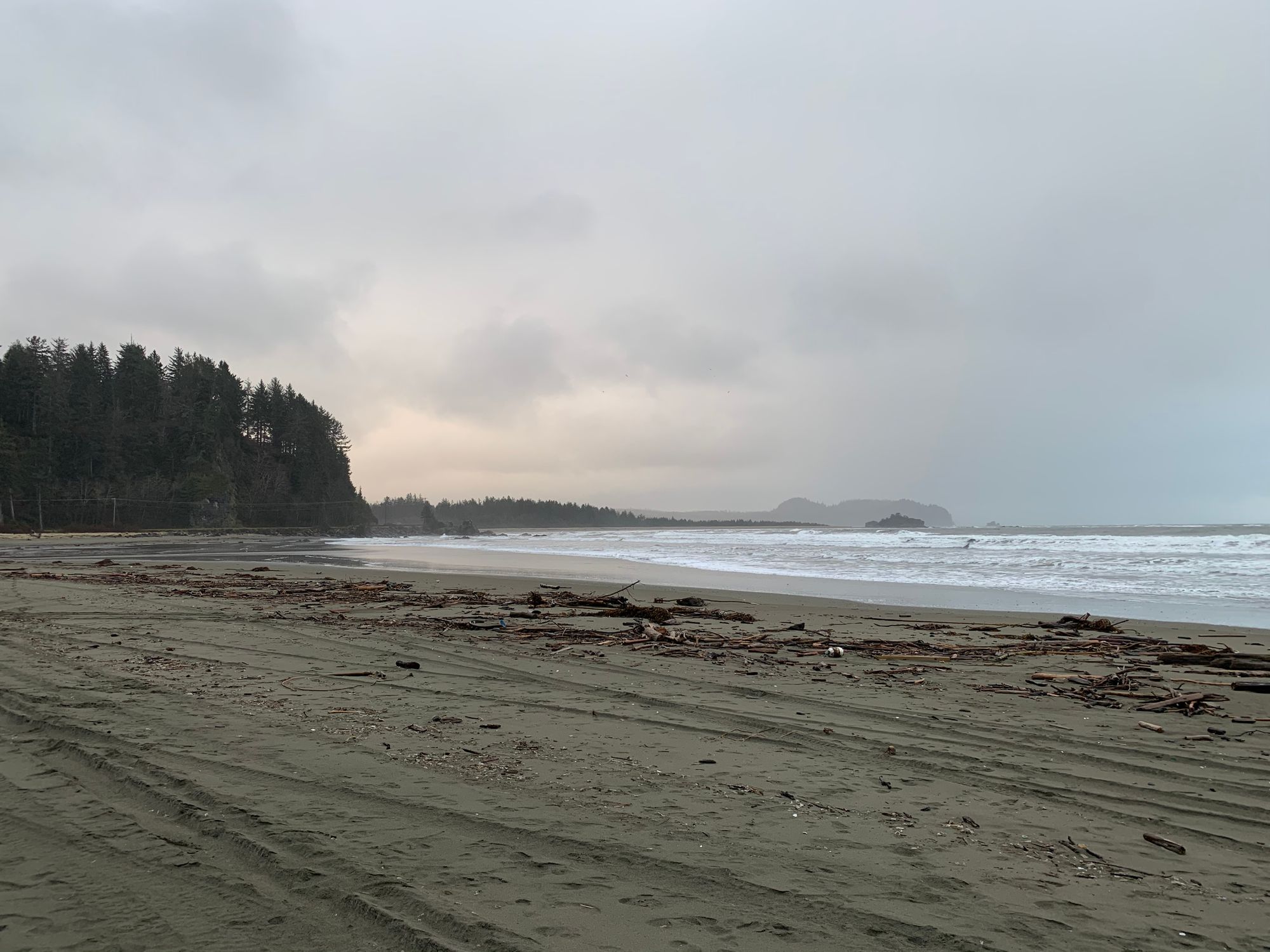
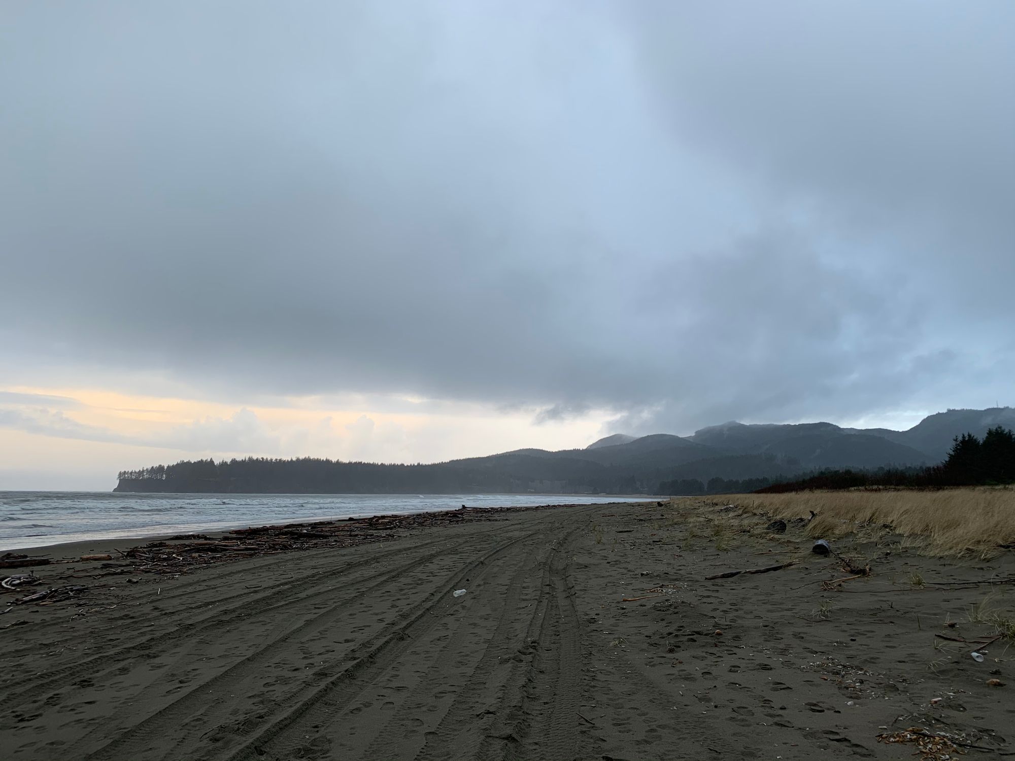
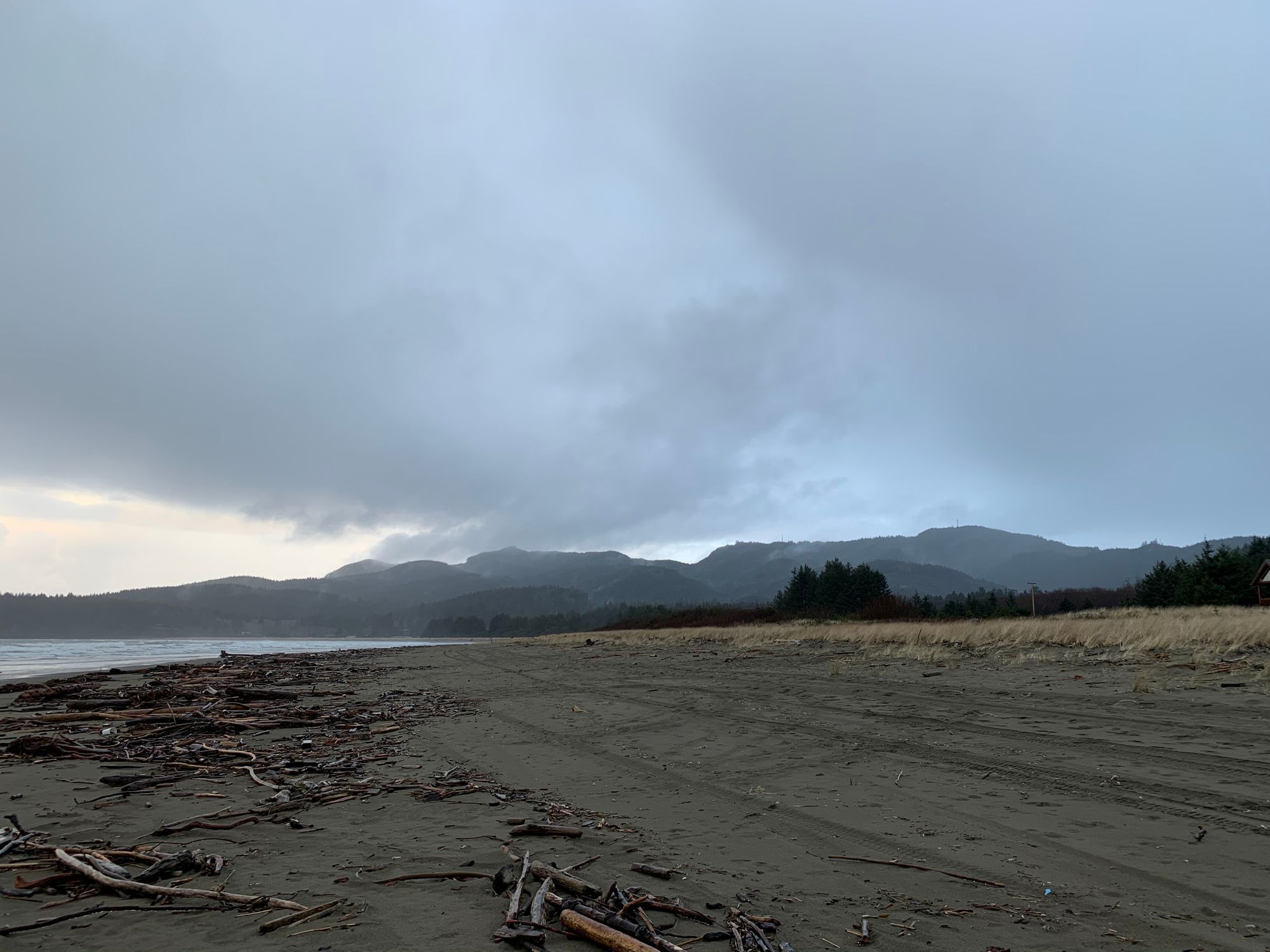
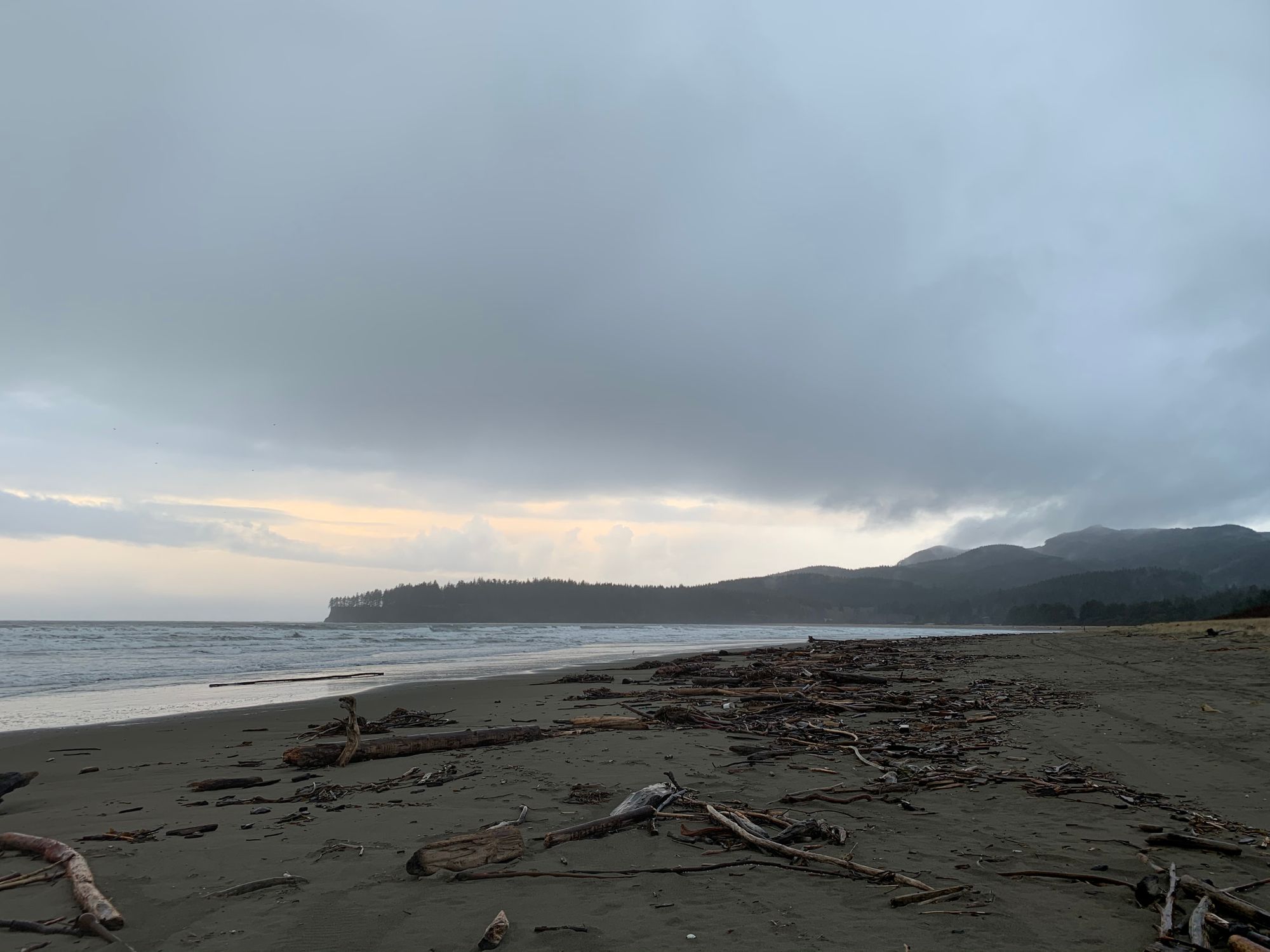
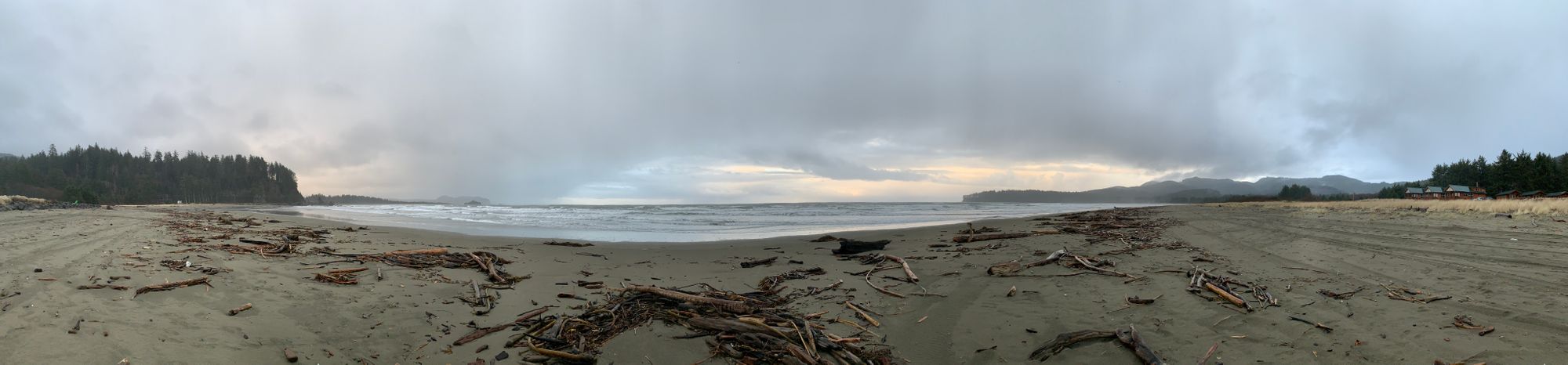
Hobuck Beach
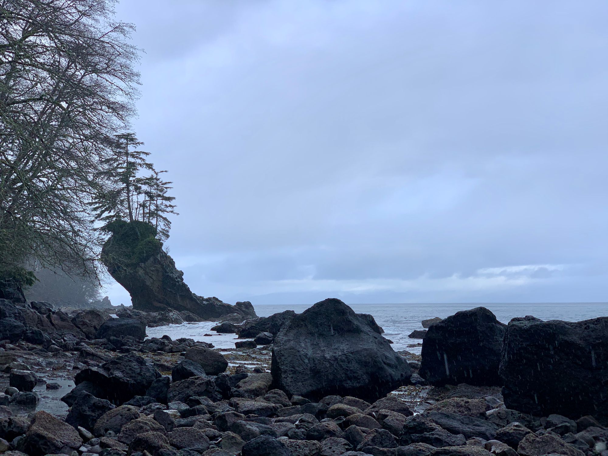
Too shy shy, hush hush, for Shi-Shi Beach
We originally wanted to make the trek down to Shi-Shi beach which is situated not too far from Hobuck and Cape Flattery, but after a brief stint of sunshine, we were ultimately greeted with a strong rain storm and decided that it might be best to tackle that long hike another day.
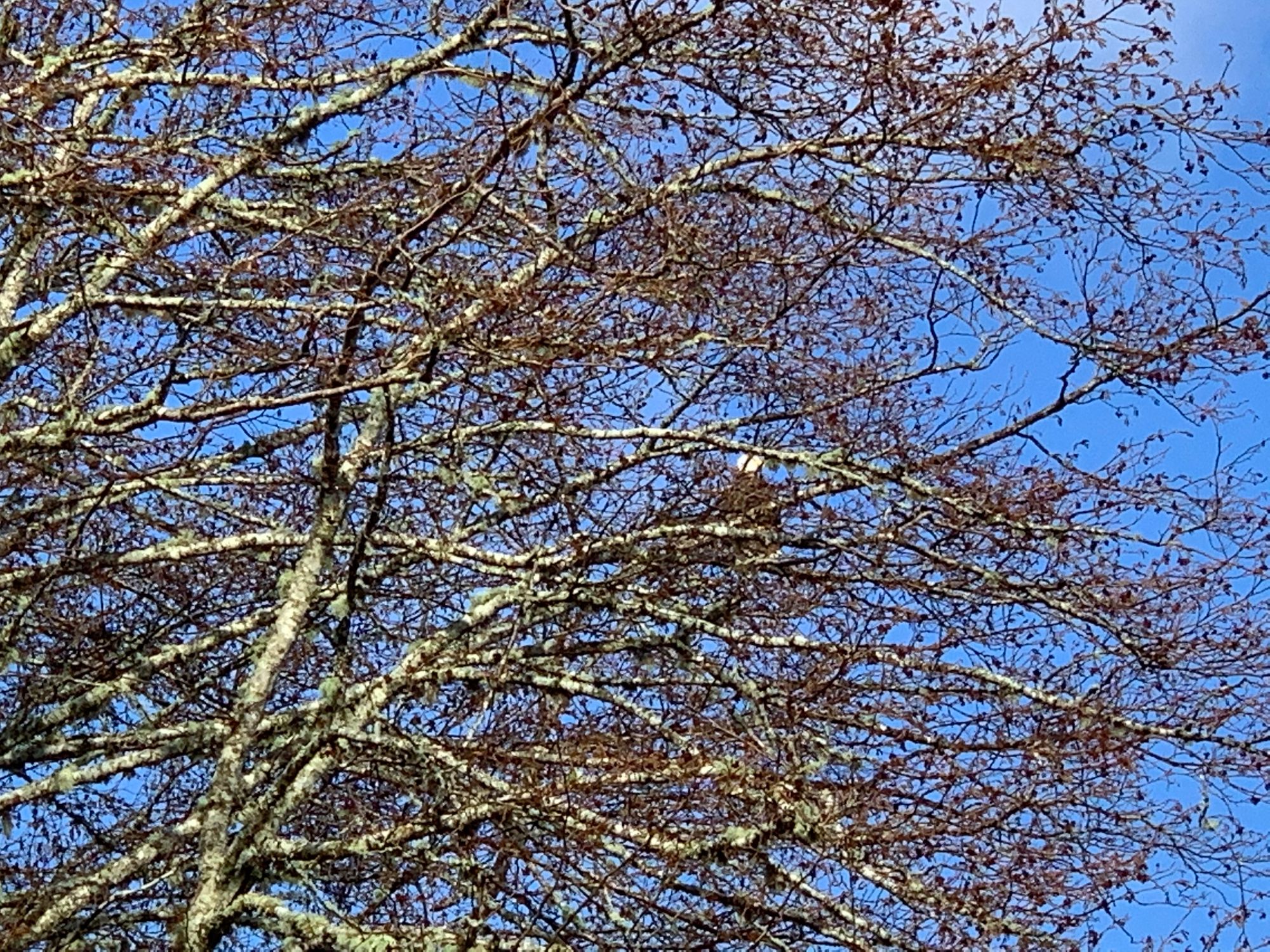
So we decided to meander our way back home. I thought it best to take SR112 to the 101 - as one does to go to Forks, but going north takes us to Port Angeles and beyond. The meandering paid off with some great vistas along the Straight of Juan de Fuca. We say a heard of elk, luckily only grazing in a field and not gamboling on to the road. The best sights had to be the stunning rock formations and the secluded beaches. Seeing bald eagles perched by the side of the road was - well all of it was breath taking.
Ultimately, it was a great decision to not go to Shi-Shi. Meandering was much more our speed and we got to see so many things that most people just pass on by on their way to the "tourist" locations. Also, when we were driving along the 101, the rain turned to snow. This was something I was not prepared for, at all. It was beautiful to see Olympic National Park covered in fresh snow, yet at the same time, I had no experience driving on it and we didn't have chains. A part of me wanted to stop, take pics, and play a bit in the snow, but it was really coming down and sticking. The highway went from slick black, to soft grey, to white in a matter of minutes.
With no preparations, it was ill advised to frolic out in the wintery white stuff as much as we wanted to. I was mostly afraid of ice, black or otherwise, on the road and just causing an accident. The 101 out there through the national park are not the easy cake walks one might think of. The road is well travelled, so there was that going for us, but there are many hills and turns and edge of a mountain type passes. Couple that with the added bonus of ice and snow... yeah I'm glad to have just made it down the mountain in one piece.
Overall, I would so do this again. However, next time I will be prepared. Take a game or a book for the long night. Bring along better provisions and a hard copy map.